French Tourane: The Chessboard Town on the Han River
Tourane was the official name of Da Nang under French rule, from 1888 until 1950. Edict 576 of 1 October 1888 made it a concession, and a decree of 24 May 1889 created the municipality. The French laid out a chessboard town on the Han River with stations, a tramway to Hoi An and an airport.
In this guide
- Tourane, the French name of Da Nang
- Edict 576 and the decree founding the city
- The boundaries grew
- Before the city
- The French quarter on the river
- The port
- Stations, railway and the tram to Hoi An
- The cathedral, 1923-1924
- The sky over Tourane
- People and new trades
- Three phases, one heritage
- Read next
- Common questions
Tourane, the French name of Da Nang
Tourane was the official name of the Han and Da Nang land under French rule, from 1888. In 1950 the French handed the government back to the Vietnamese and the city took back the name Da Nang. This page tells how Tourane was made, what was built and what is left, with old postcards.
The name was not a French invention. It dates from the 16th century. Most hypotheses derive it from how foreign missionaries, merchants and navigators pronounced the local name. The landing at the same harbour is told in the Franco-Spanish landing at Da Nang.
Edict 576 and the decree founding the city
The first document is edict 576 of the Dong Khanh reign, dated 1 October 1888. It put into effect article 18 of the Patenotre treaty of 6 June 1884, on the limits of the concession areas of Hanoi, Haiphong and Tourane. On 3 October 1888 Governor-General Richaud signed a decree approving it.
Tourane then covered five communes: Hai Chau, Phuoc Ninh, Thach Thang, Nam Duong and Nai Hien Tay. For the first time Da Nang appeared on national and international maps as an administrative unit, not just a port.
The city came later. On 24 May 1889 a decree formally created Tourane as a second-class municipality. A Doc ly (mayor) headed it, with a municipal council mostly French: a chairman and six councillors.
The boundaries grew
- An edict of 27 September 1897 ceded further communes, among them An Hai and Co Man.
- An edict of 15 January 1901 ceded eight more.
- A decree of 19 September 1905 separated Tourane from Quang Nam province as an independent unit of 19 communes.
Before the city
Before 1888 the roads were mainly village roads and transport was horse or ox carts. A French account of 1897 lists three or four public buildings, about 12 European-style houses and a village.
To make room for the new quarter, some native villages on the west bank of the Han were moved in 1888-1889. Most Nguyen military defences at Tourane were destroyed.
The French quarter on the river
Old maps and photographs show public buildings in an orderly line along the Han River, and central streets laid out in a chessboard pattern. Most public buildings stood within 200 m of the riverbank. Later, crushed-stone streets gradually formed a grid of longitudinal and transverse axes. All streets were named after places or people.
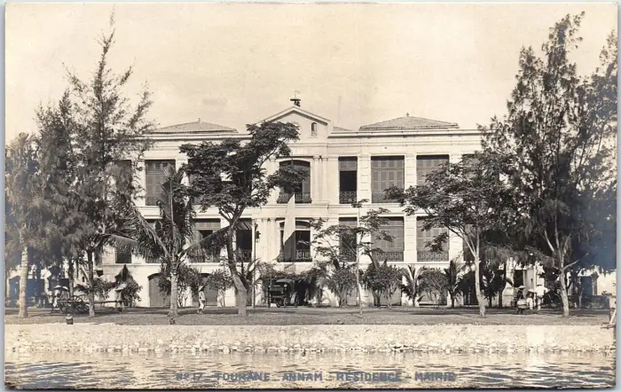
The town was split into the French quarter (quartier français) and the native quarter (quartier indigène). The French quarter gathered administrative offices and large companies, on paved roads. The Résidence-Mairie postcard above shows the kind of building found there, seen from the river.
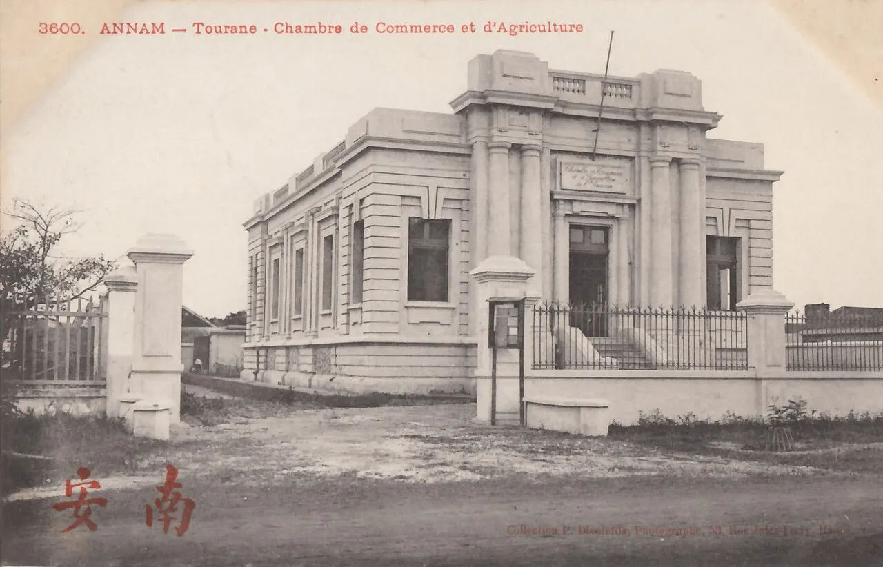
The Chambre de Commerce et d’Agriculture is a typical commercial building on a postcard: columns at the entrance, an iron fence and gate posts in front.
The port
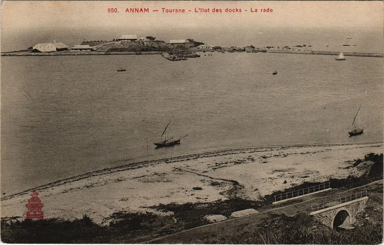
A coastal town needed ships. An early French description says houses sprang up like mushrooms, a quay was built and ships carried goods from the bay into the port. Tourane was a stop on the sea route Haiphong-Tourane-Quy Nhon-Saigon. Messageries Maritimes, called the Horse Head Line, had a branch here.
Stations, railway and the tram to Hoi An
The main station was built in 1905 on Lagrie street, now Hai Phong street. Han Market station stood on Quai Courbet, now Bach Dang street. The Tourane-Hue railway opened in 1906 and the Tourane-Nha Trang line in 1936.
For Hoi An, a consortium led by the tea merchant Dérobert lobbied for a narrow-gauge steam tramway between Tourane and Faifo. It opened on 1 October 1907 with three round trips daily. Passengers alighted right outside the Han Market.
The line did not last. It was beset by technical problems. A typhoon destroyed the track near Marble Mountain on 27 October 1915, and the line closed for good on 31 December 1915 after eight years. For the trading port itself, read Hoi An history.
The cathedral, 1923-1924
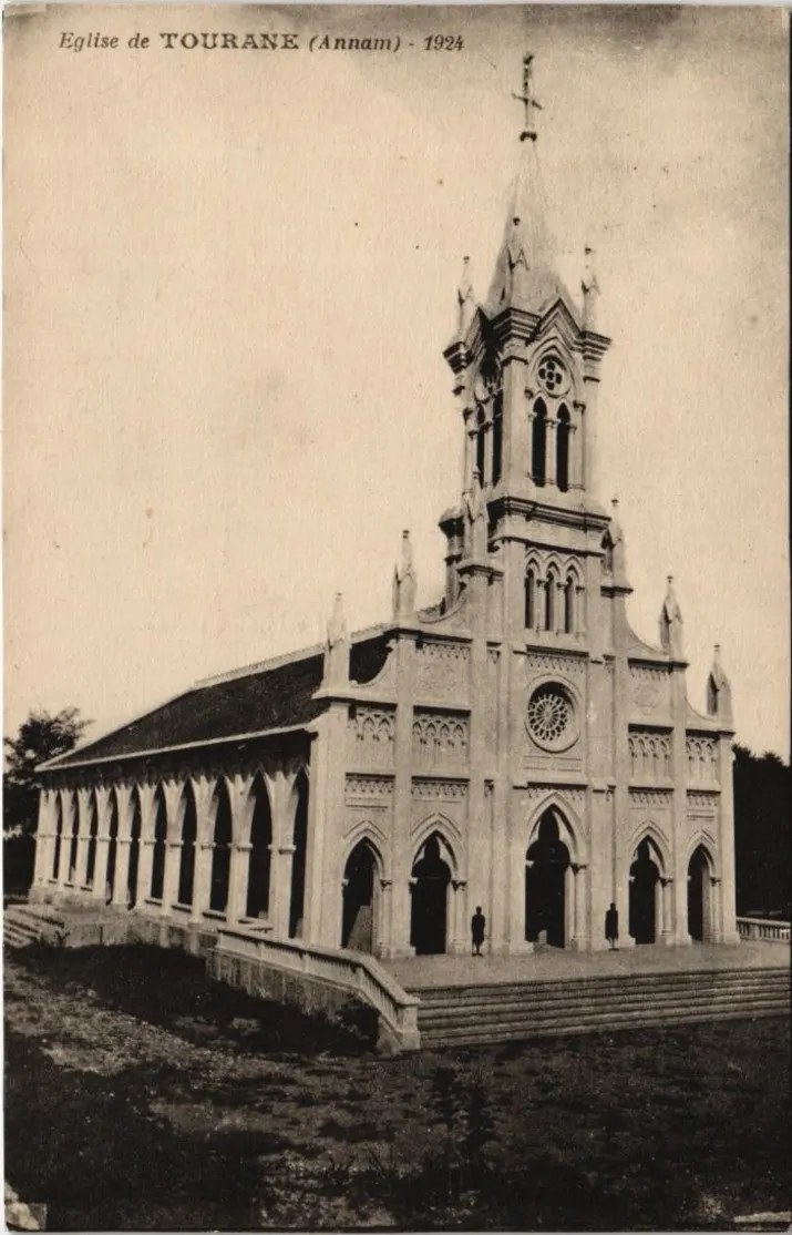
The present church was built from February 1923 to September 1924. It was blessed on 14 September 1924. It is Gothic in style. On the roof, at the lightning rod, a grey alloy rooster serves as a weathervane.
The sky over Tourane
In 1913 local people first saw an aircraft take off. The pilot Marc Pourpe flew a Blériot XI over the town. The airport was begun only in the early thirties. In 1940 Japan used it as a military base.
People and new trades
New social classes arose, such as interpreters, alongside rickshaw pullers, dock workers, road workers and factory workers.
Three phases, one heritage
A study divides the urbanisation of Tourane into three phases: 1888-1918, 1919-1939 and 1940-1950. The centre of the city is today considered notable urban and architectural heritage.
Read next
A statue garden in the Tourane park grew into a famous museum: see the Cham Sculpture Museum. For the story of the same harbour, read the Franco-Spanish landing at Da Nang.
Photo credits
- The Résidence-Mairie of Tourane seen from the Han River, on a postcard from before 1945: Wikimedia Commons, postcard Tourane - Annam - Résidence-Mairie, public domain (opens in a new tab) (Public domain)
- Postcard of the Chambre de Commerce et d'Agriculture, Tourane, early 20th century (publisher P. Dieulefils): Wikimedia Commons, postcard of the Chamber of Commerce and Agriculture, Tourane, public domain (opens in a new tab) (Public domain)
- The islet of the docks and the roadstead of Tourane on an early 20th-century postcard: Wikimedia Commons, postcard Annam - Tourane - L'Ilot des docks - La rade, public domain (opens in a new tab) (Public domain)
- The church of Tourane on a postcard dated 1924: Wikimedia Commons, postcard Eglise de Tourane (Annam) - 1924, public domain (opens in a new tab) (Public domain)
Common questions
What was Tourane?
The official name of the Han and Da Nang land under French rule, used from 1888. In 1950, when the French handed back the government, the city took back the name Da Nang.
When did Tourane become a French concession?
Edict 576 of 1 October 1888 made Hanoi, Haiphong and Tourane concessions. On 3 October 1888 the Governor-General approved it.
When was the city of Tourane founded?
On 24 May 1889 a decree formally created Tourane as a second-class municipality.
Where does the name Tourane come from?
The name dates from the 16th century. Most hypotheses derive it from how foreign missionaries, merchants and navigators pronounced the local name.
What did the French build in Tourane?
A chessboard centre along the Han River with public buildings, the main station in 1905, Han Market station and an airport begun in the early thirties.
Was there a train from Da Nang to Hoi An?
A steam tramway opened on 1 October 1907 and closed for good on 31 December 1915, after eight years.
When was the Da Nang cathedral built?
The present church was built from February 1923 to September 1924 and blessed on 14 September 1924.
Read next
- Da Nang Under Attack: The Landing in Old Prints and MapsVerified 18 October 2026
- Hoi An History: The Faifo Trading Port and Old TownVerified 18 October 2026
- Cham Sculpture Museum, Da Nang: The Tourane GardenVerified 18 October 2026
- French Tourane: The Chessboard Town on the Han RiverVerified 18 October 2026
General information checked against the sources listed above, not legal advice for your situation. Rules and office practice change; confirm with the relevant office or a licensed adviser before you act. See how guides are checked.
Spotted an error? Report it.